| FAQ |
| Calendar |

|
|
#1
 4th September 2012
|
||||
|
||||
|
Kondisi Barang : Baru
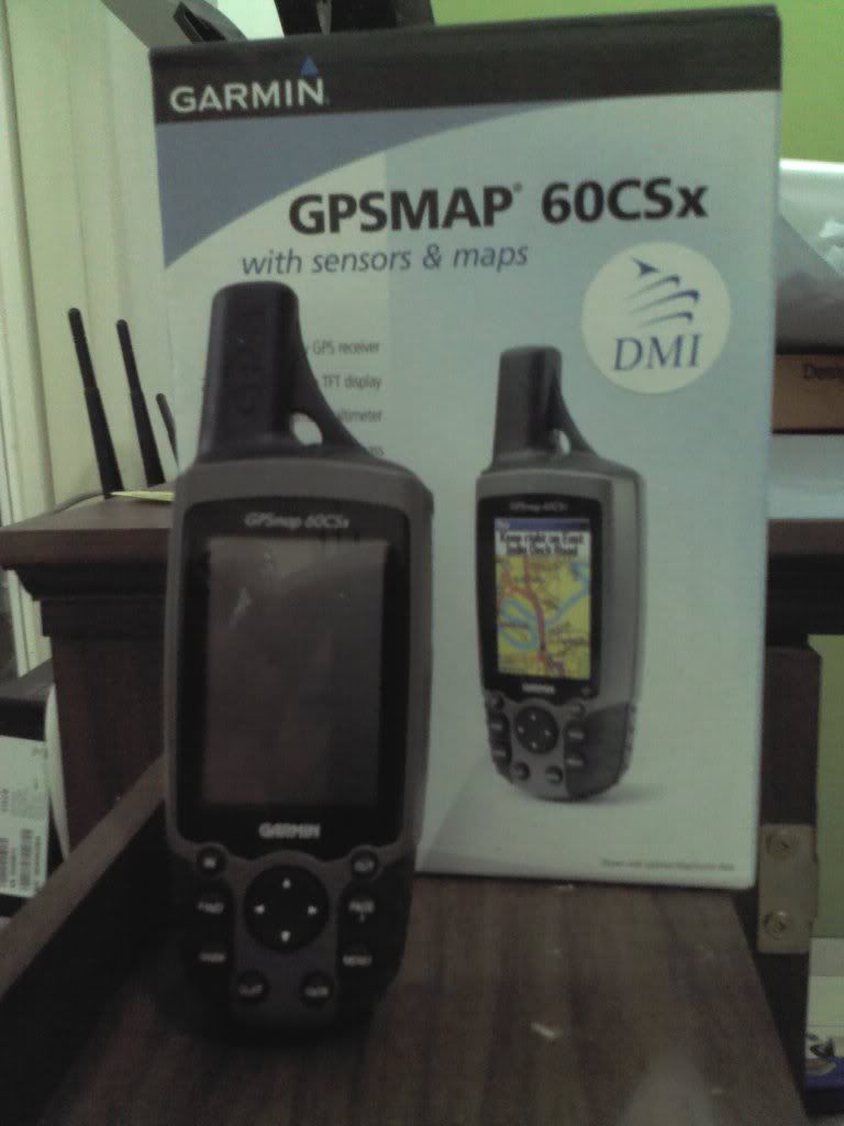
Harga : Lokasi Seller : DKI Jakarta Description : Permisi Mod.... Numpang jualin Garmin GPS 60 csx.. Kondisi : bekas like new (95%)... baru dipake sekali... itu juga bentar makainya...trus masukin dus laghee... Tgl. Pembelian 05-04-2012 jadi masih ada garansi selama 10 bulan. [/spoiler] Spoiler for open this:
Spoiler for open this:
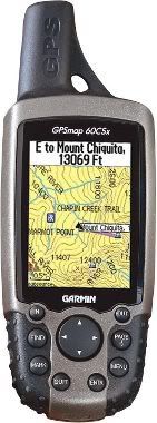
GPSMAP 60CSx Features: � New high-sensitivity WAAS-capable GPS receiver by SiRF � Built-in quad-helix receiving antenna with remote antenna capability � Unit dimensions: 2.4� W x 6.1� H x 1.3� D � Display: 1.5� W x 2.2� H, 2.6�-diagonal, 256-color, transflective TFT (160 x 240 pixels) � Supports English, Spanish, Portugese, and French languages. � Weight: 7.5 ounces with batteries (not included) � Sensors: -Electronic compass displays accurate heading while standing still -Barometric altimeter � microSD card slot allows for storage of optional MapSource detail (64 MB microSD included) � LED backlit display and keypad � Battery life: 18 hours (typical use) using two AA alkaline batteries � Includes a built-in Americas autoroute basemap with automatic routing capabilities, including highways, exits, and tide data (USA only) � Internal memory is preloaded with a marine point database � 1,000 user waypoints with name and graphic symbol; 50 reversible routes � Position formats include Lat/Lon, UTM, Loran TDs, Maidenhead, MGRS, user grid, and more � Large-numbers option for easy viewing; dual-position display mode � Trip computer provides odometer, stopped time, moving average, overall average, total time, max speed, and more � 10,000-point automatic track log; 20 saved tracks (500 points each) let you retrace your path in both directions � Elevation computer provides current elevation, ascent/descent rate, minimum/ maximum elevation, total ascent and descent, average and maximum ascent and descent rate � Navigation instructions can be shared with repeaters, plotters, and autopilots using NMEA protocols through the dedicated serial port � Built-in celestial tables for sun and moon calculations and the best times to fish and hunt � Compatible with most MapSource products. See the MapSource Compatibility table (top right) for a list of software that Garmin recommends with this product. � Water resistant: IEC 60529 IPX7 standards SOLD OUT Fast response 081806363467 
|
 |
|
|